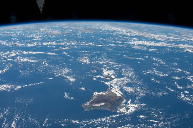


Kauaʻi is often called the oldest of the main Hawaiian Islands, and its landscape looks the part—in the best possible way. Deep valleys cut through green mountains, sea cliffs rise above the Nā Pali Coast, and Waimea Canyon opens a window into layers of old lava. Just beyond the western horizon, drier and lower Niʻihau carries another part of the same regional story.
The two islands are neighbors, but they did not begin as one volcano. Kauaʻi and Niʻihau grew from separate volcanic systems about six million years ago. They rose close together as the Pacific Plate moved over the Hawaiian hot spot, each building its own mountain from the deep ocean floor.
Two volcanoes, not one giant island
Niʻihau probably began first, although the earliest part of both islands’ histories is hidden beneath younger lava and the sea. Repeated eruptions built broad shield volcanoes. Niʻihau once extended farther than it does today, and a major collapse removed a large part of the volcano early in its life.
Kauaʻi grew into the larger mountain. Its main volcanic center lay in the east-central part of the present island, around the Līhuʻe Basin. Lava repeatedly filled low areas as the volcano shifted, settled, and continued to erupt. By roughly four million years ago, the great shield-building phase on both islands was largely over.
Kauaʻi and Niʻihau were close, and changing sea levels altered the amount of land visible around them, but the evidence does not show them as one broad, confirmed landmass. It is more accurate—and more interesting—to picture two old volcanoes evolving side by side.
When rain became the main sculptor
After frequent eruptions ended, erosion took over. Kauaʻi’s wet interior gave streams enormous power to cut into the volcanic rock. Valleys lengthened. Ridges sharpened. Waves worked at the coast while giant landslides carried pieces of the island into deep water.
Waimea Canyon is part of that long carving process, not a single volcanic crater. The amphitheater valleys and fluted cliffs of the Nā Pali Coast are also products of time: old lava repeatedly weathered, fractured, and washed toward the sea.
Niʻihau followed a drier path. Its lower elevation and position in Kauaʻi’s rain shadow limited the streams that could carve it. That helps explain why the two islands can share a volcanic age yet look so different today.
A late volcanic encore
Neither island’s volcanic story ended cleanly after the main shield went quiet. Scattered eruptions returned after long pauses. On Kauaʻi, these younger Kōloa eruptions produced small cones and lava flows, including features around the Līhuʻe Basin. Niʻihau also experienced a long period of smaller renewed eruptions.
These late eruptions did not rebuild either island into a youthful giant. They were more like an encore—local additions laid across an already aging landscape.
Watch Kauaʻi and Niʻihau change
The animation shows the islands on a shared timeline while keeping them as independent volcanic systems. It is especially useful for seeing how early growth gives way to erosion, sinking, and smaller renewed eruptions.
What the modern landscape reveals
The details visible today make more sense when you remember the islands’ different histories. Kauaʻi’s lush valleys reflect elevation, rainfall, and millions of years of erosion. Niʻihau’s broad dry lowlands occupy the worn remnant of another old volcano. Lehua, the small crescent north of Niʻihau, is a younger volcanic tuff cone that adds one final punctuation mark offshore.
Together, Kauaʻi and Niʻihau show that an island does not stop changing when its main eruptions end. In many ways, that is when the landscape familiar to us begins. For the wider view, read how the entire Hawaiian chain formed.

Further Reading
A few relevant next steps from Alakai Aloha.