


If you’ve ever checked the forecast for Kauaʻi and felt confused, you’re not alone. Weather on the island doesn’t behave the way most visitors expect. It isn’t simply “sunny” or “rainy,” and it rarely applies evenly across the island at any given moment.
That’s because Kauaʻi’s weather is shaped by a powerful combination of trade winds, steep mountains, and shifting large-scale weather systems. The result is an island that creates its own patterns—predictable once you know what to look for, but rarely uniform.
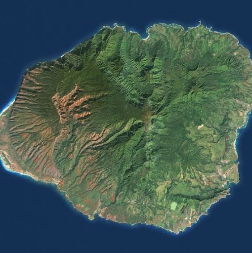
Using satellite imagery as a lens, here are five weather patterns that explain how Kauaʻi really works.
Typical Trade Winds
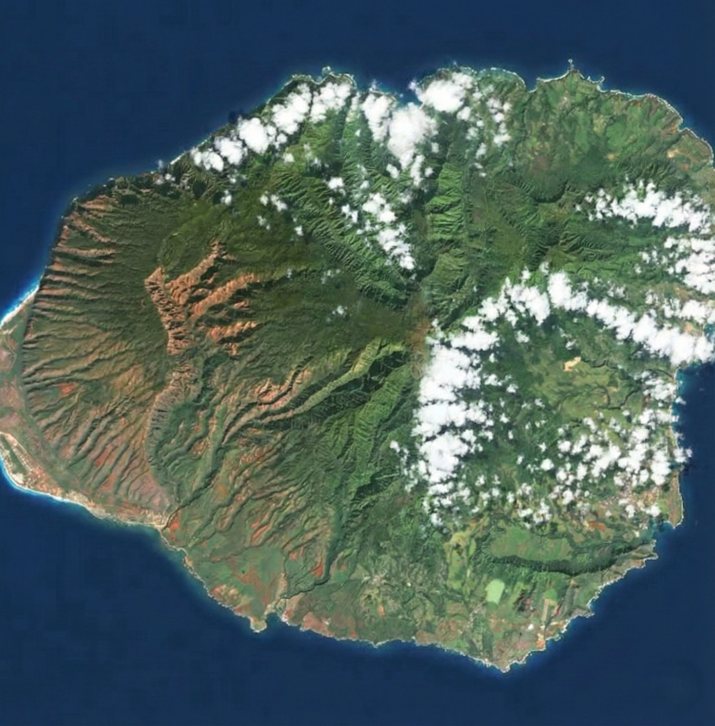
This is the baseline. Most days on Kauaʻi fall into this category.
Under typical trade winds, steady breezes blow from the northeast. As moist air is pushed toward the island, it rises along the north and east-facing slopes, forming clouds and light showers. These clouds tend to hug the windward coastlines and interior mountains.
Meanwhile, the south and west sides of the island sit in the rain shadow of the mountains. Those areas often experience clearer skies and drier conditions at the same time that clouds linger elsewhere. This contrast is why Kauaʻi is famous for having multiple weather conditions happening at once.
When people talk about Kauaʻi’s “microclimates,” this is what they’re describing.
Kona Winds
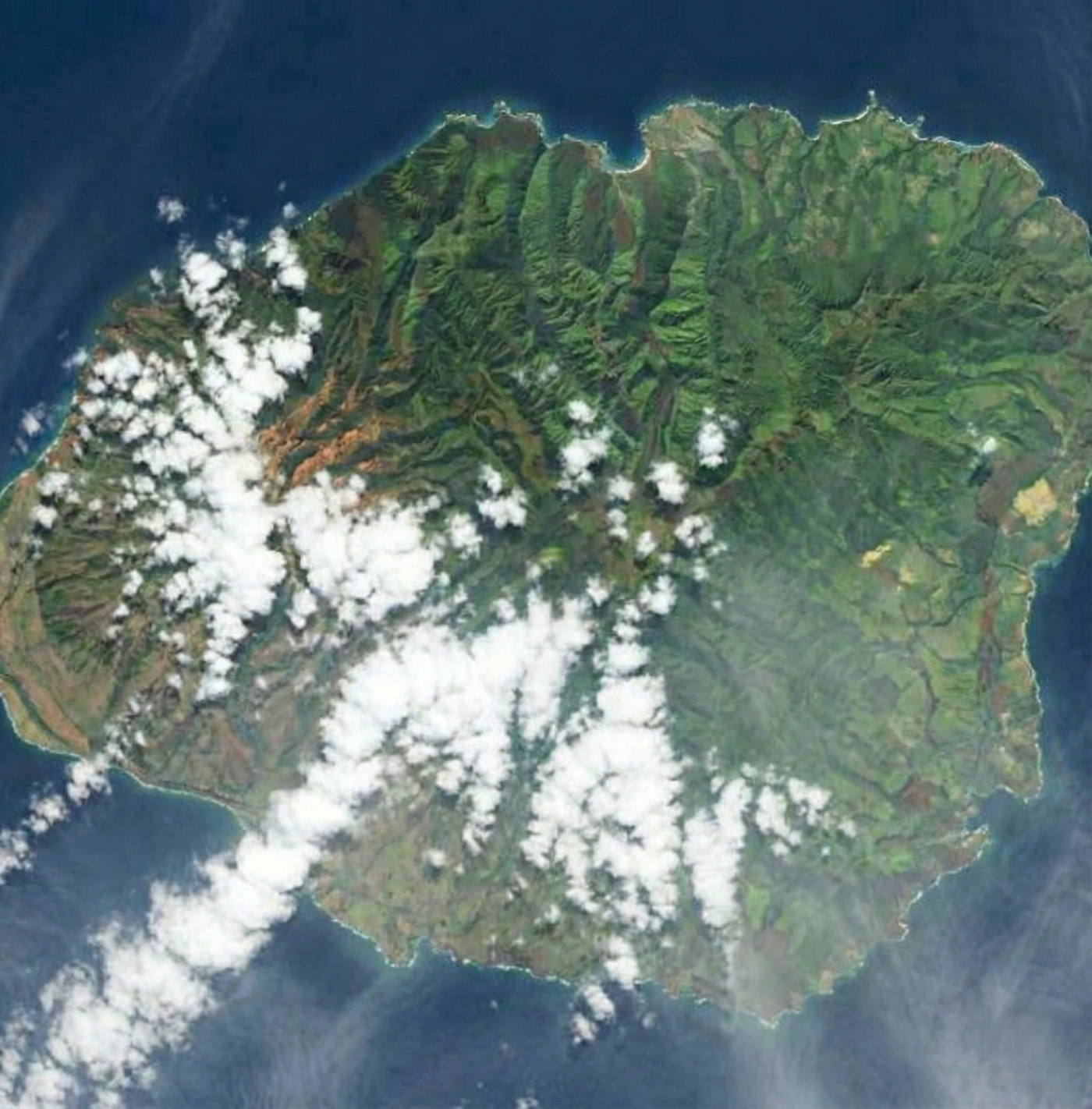
Kona winds flip the island’s usual weather pattern.
Instead of breezes coming from the northeast, winds shift to the south or southwest. When that happens, moisture approaches the island from the opposite direction, and the familiar windward–leeward split breaks down.
Clouds and rain tend to move onto the south and west sides, areas that are typically drier. The North Shore, surprisingly, can end up calmer or clearer than usual. For visitors staying in traditionally sunny areas, Kona winds often feel like the forecast got it wrong—when in reality, the entire pattern has reversed.
Locals pay close attention when Kona winds are mentioned, because they signal a meaningful change in how the island behaves.
Kona Storm
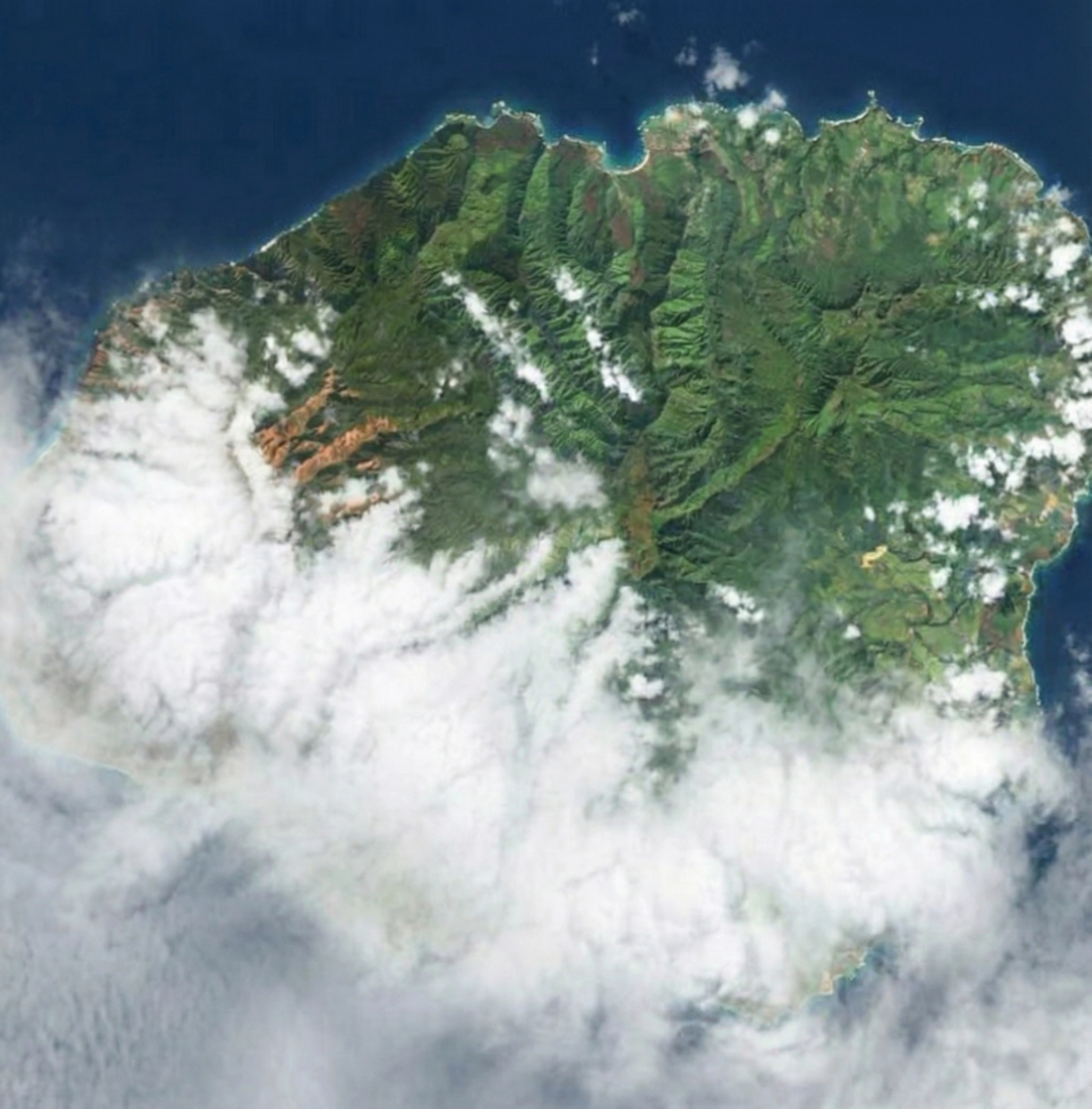
A Kona storm is a more intense and organized version of the Kona wind pattern.
These systems often involve a strong low-pressure setup that stalls near the islands. Instead of passing quickly, the storm lingers, feeding moisture into the island for extended periods. Cloud cover becomes widespread, rainfall can be heavy, and flooding is more likely—especially in low-lying and stream-adjacent areas.
Unlike quick trade wind showers, Kona storms feel persistent. They’re the events most often associated with significant rain totals and memorable “stormy” stretches of weather on Kauaʻi.
Rainy Season
Kauaʻi does have a wetter time of year, but it’s important to understand what “rainy season” actually means.
Rather than constant rain, the rainy season reflects a higher frequency of wet days. Storm systems are more common, moisture is more readily available, and unsettled patterns occur more often—especially during winter months.
Some days may still be bright and beautiful. Others may feature widespread cloud cover or passing showers. The key difference is variability: trips during the rainy season can feel dramatically different from one another, even within the same month.
Rainy season sets the background conditions, but it doesn’t dictate the weather on any single day.
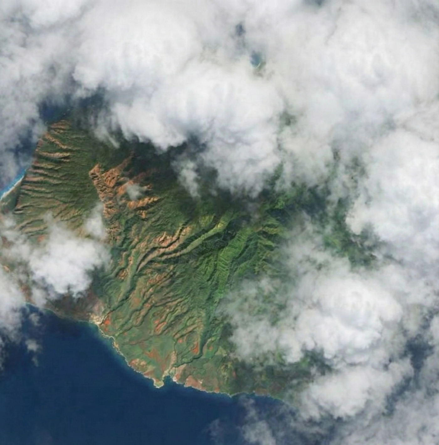
Almost Never
A fully cloudless Kauaʻi is something many people imagine—and something satellite imagery almost never shows.
Even on the clearest days, clouds tend to cling to the island’s mountains, drift along the windward coast, or form briefly over the interior as the day warms. Thin high clouds often pass overhead, invisible from the ground but obvious from space.
This doesn’t mean Kauaʻi is gloomy. It means the island is alive, constantly interacting with wind, water, and terrain. Clouds are not a failure of good weather here—they’re part of the system that makes the island green, dramatic, and endlessly changing.
Bringing It All Together
Kauaʻi’s weather isn’t random. It follows patterns shaped by wind direction, topography, and large-scale atmospheric forces. Once you understand those patterns, the island feels less unpredictable and far more intentional. Check out our interactive weather tool to see how these patterns translate to actual conditions across each region.
The goal isn’t to chase cloudless skies. It’s to understand how and why the island looks the way it does—and to plan with that reality in mind. When you do, Kauaʻi stops feeling confusing and starts feeling exactly like what it is: a place that makes its own weather.

Further Reading
A few relevant next steps from Alakai Aloha.
 BlogHow to Build a Rainy-Day Backup Plan for Your Kauai Trip
Don't let rain spoil your Kauai vacation! Get practical tips & activity ideas to build a flexible rainy-day plan and enjoy the island's magic, rain or shine.
Editor's pick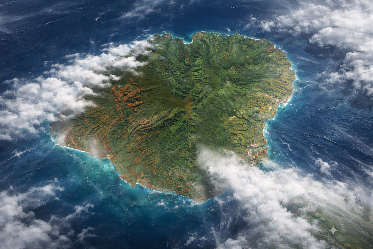 ToolCompare island weather by region
See how rain, wind, and conditions vary around the island before you choose your day plan.
Useful planning tool BlogWhen to Visit: A Month-by-Month Guide to Weather, Crowds & Costs
Discover the best time to visit Kauai with our month-by-month guide on weather patterns, visitor trends, local events, and budgeting tips for your adventure.
Editor's pick BlogSouth Shore vs. North Shore: Where Should You Stay?
Choosing between Kauai's South & North Shore? Compare sunny Poipu vs lush Hanalei based on weather, vibe, scenery & activities to find your ideal Kauai stay.
Editor's pick